My friend runs a website called The Map Room which focuses on hiking, river tracing and other outdoor activities in Taiwan. He has written a series of posts called Learn to Hike in Taiwan which, as can be expected from the name, provide the reader with some basic information about hiking trails suitable for beginners. Since we have to bring our son along for hiking, I figured it could be a good idea to try one or two of the trails from this series, just to see how well it works while carrying a toddler on your back. We started with the (supposedly) easiest one: Flame Mountain.
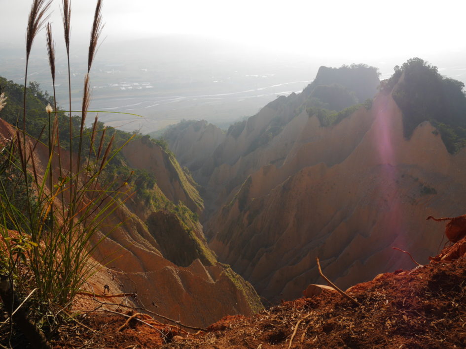
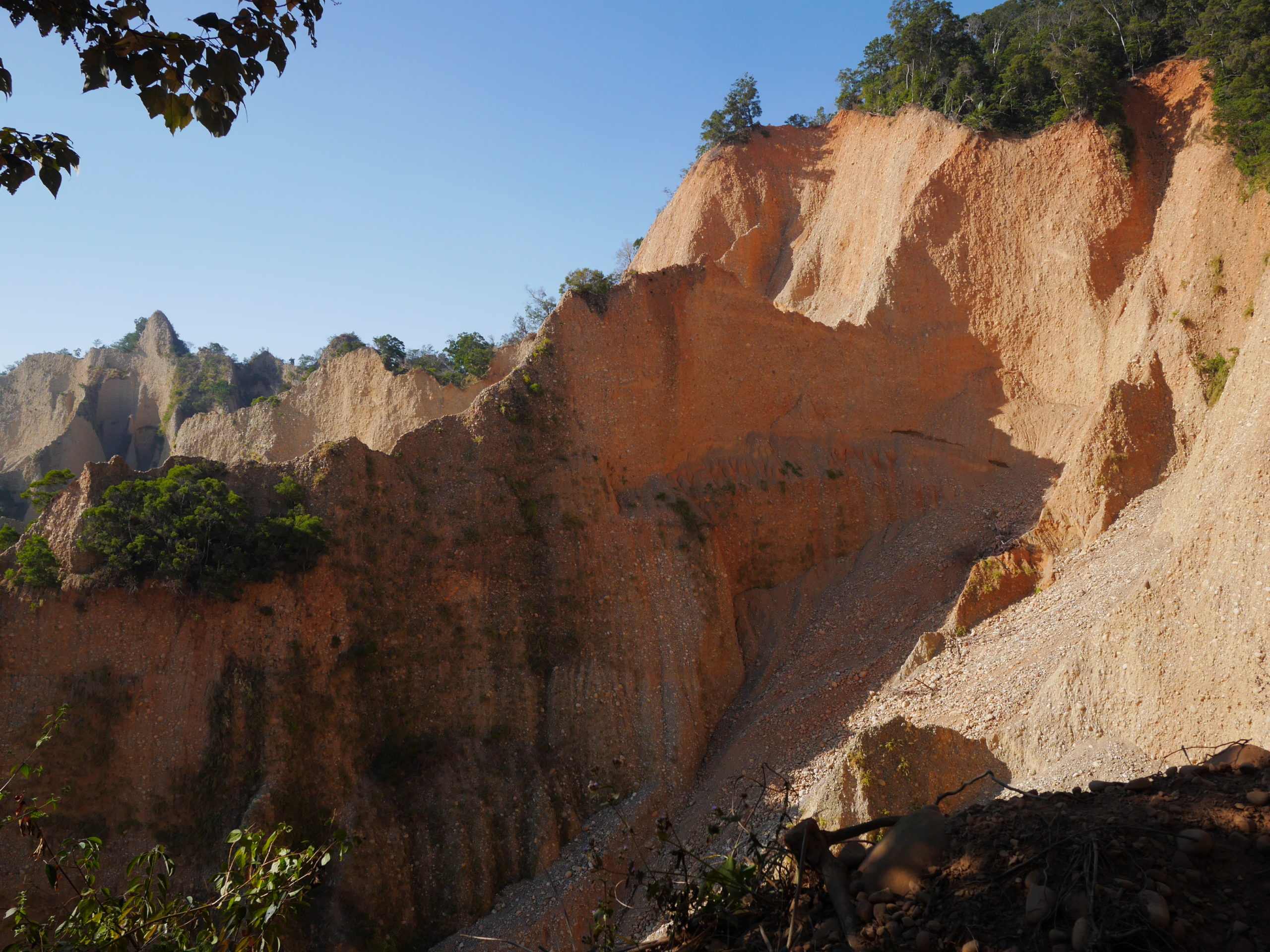
Flame Mountain is a pretty low mountain in the south end of Miaoli county. What’s special about it is that there are some steep slopes and jagged cliffs that are free of vegetation, where the orange earth lies bare in the sunlight, giving it a very characteristic look which, when the sun hits it right, is reminiscent of fire. As you might have guessed, this is characteristic look is what gives the place its name. There are many jungle clad mountains in Taiwan, and they are all beautiful, but I like Flame Mountain because it stands out from the rest.
The trail head is right next to the highway with a large parking lot underneath the highway bridge. There are two possible ways to go, one along the ridge where you can see the “flames” from several points along the way, and one through the jungle. Like most people, we took the ridge route up to the peak then came down though the jungle. The first one or two kilometers of the trail is a near constant upward slope – steep enough for stone steps along much of the way – with only a few short flat sections. In addition, the low altitude of Flame Mountain means it’s just as hot up on the trail as down on the ground. According to The Map Room this should be pretty easy hiking but we found that the combination of the upward slope and the heat made it rather tiring after a while, especially with ten kilos of toddler on the back. This is not to say it’s a particularly difficult hike, I believe that most reasonably fit people can do it, but it’s not a walk in the park either.
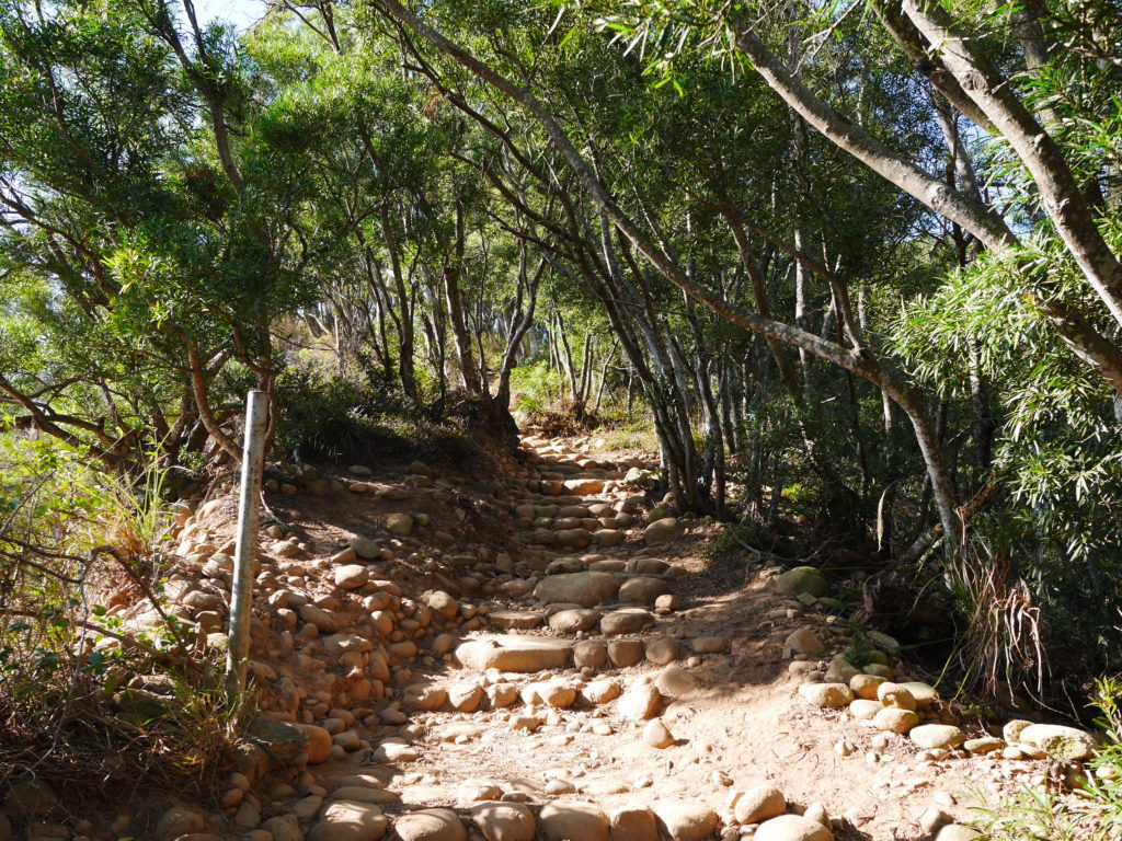
Start of the trail 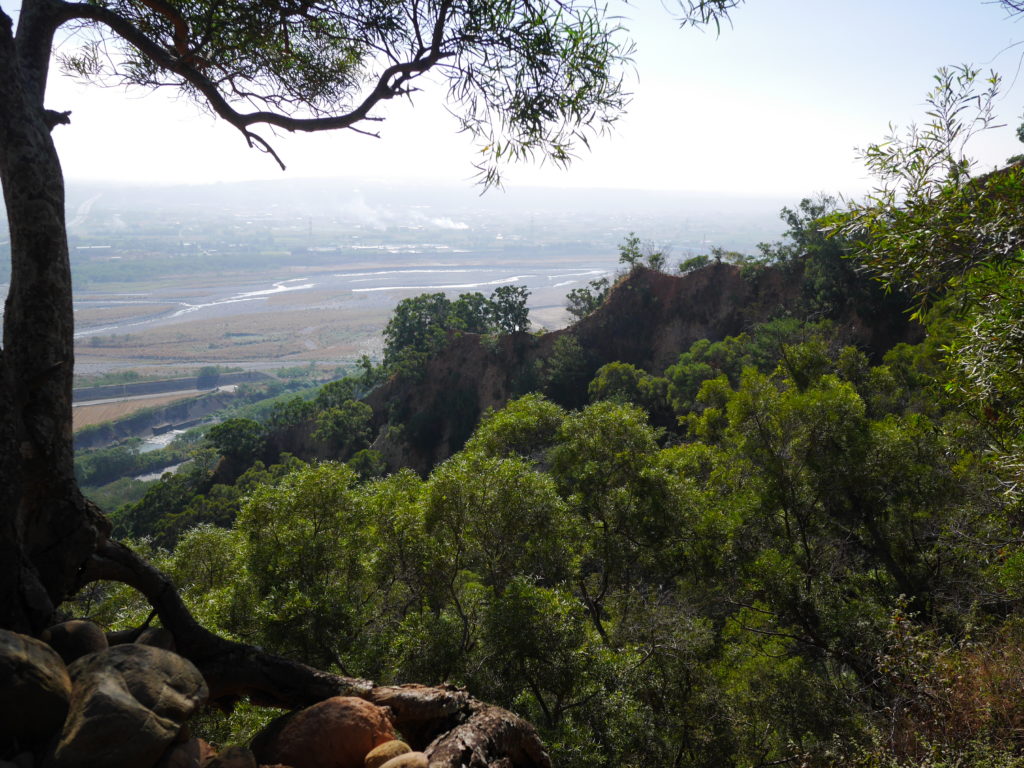
Getting a first glimpse of the flames 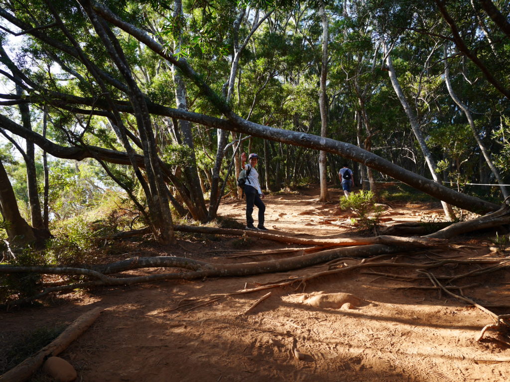
Heading further up 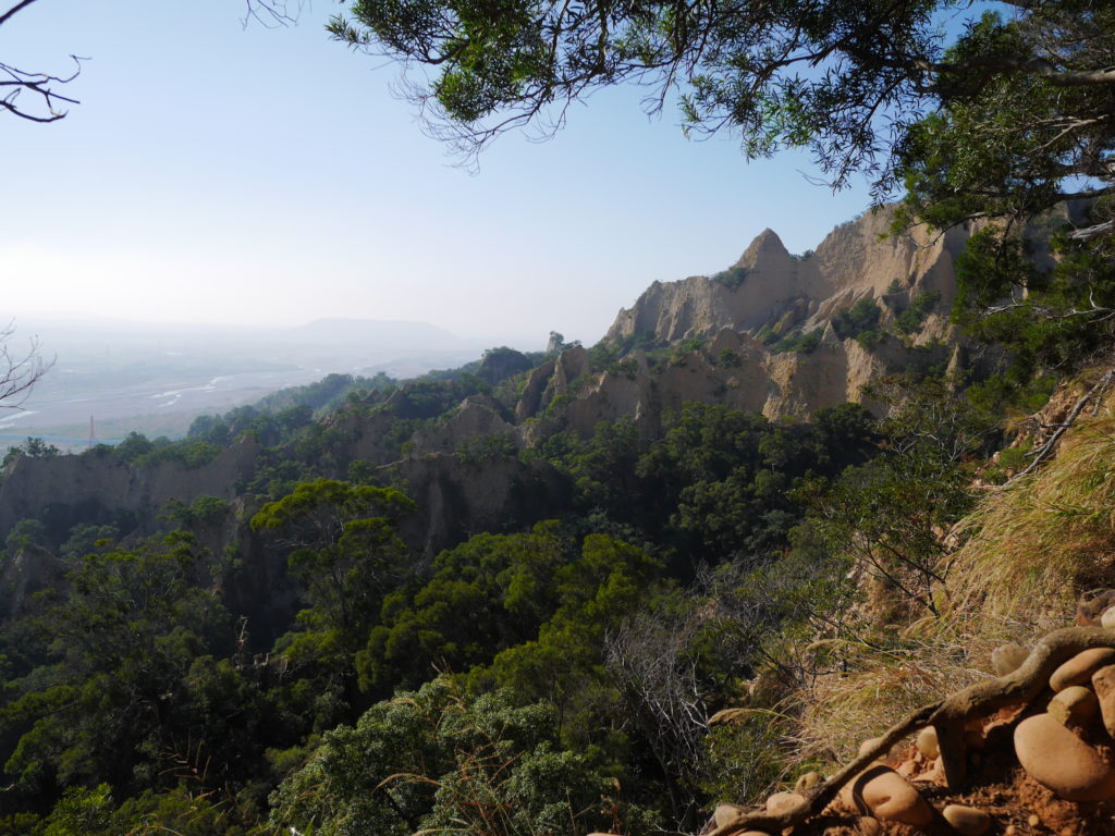
Getting closer 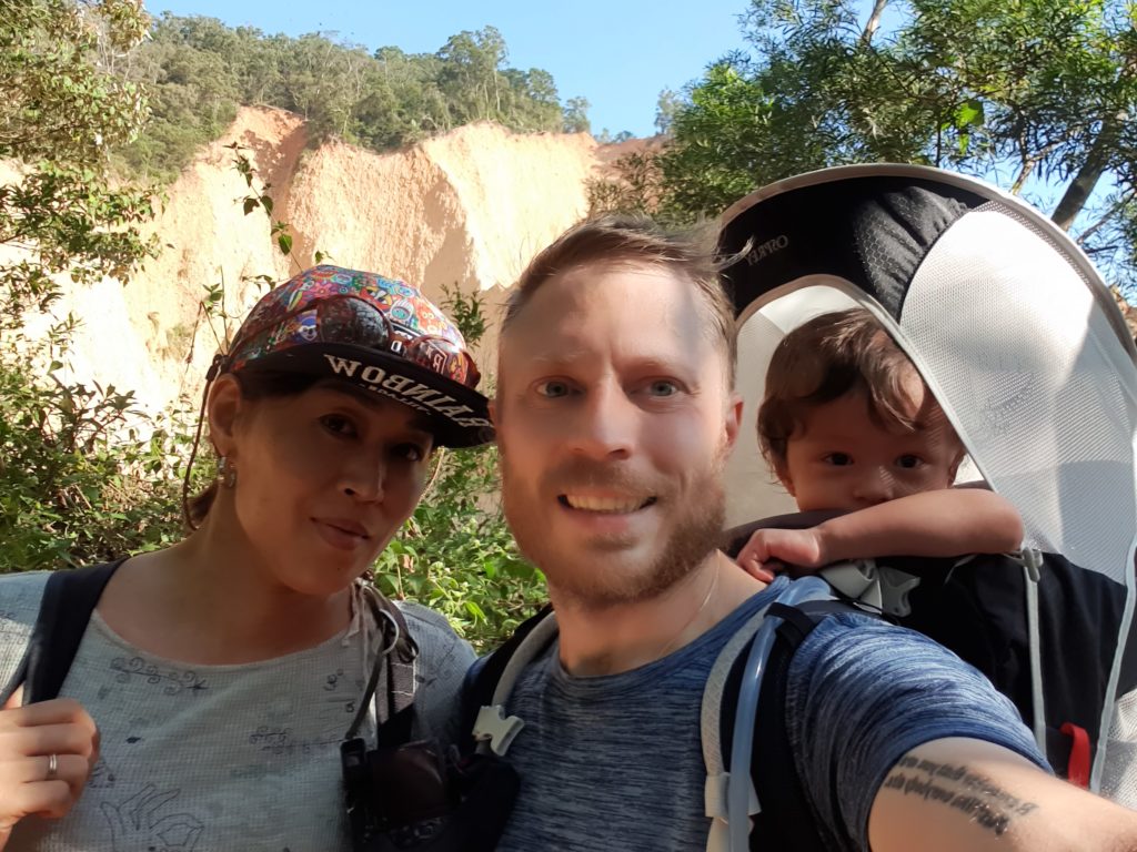
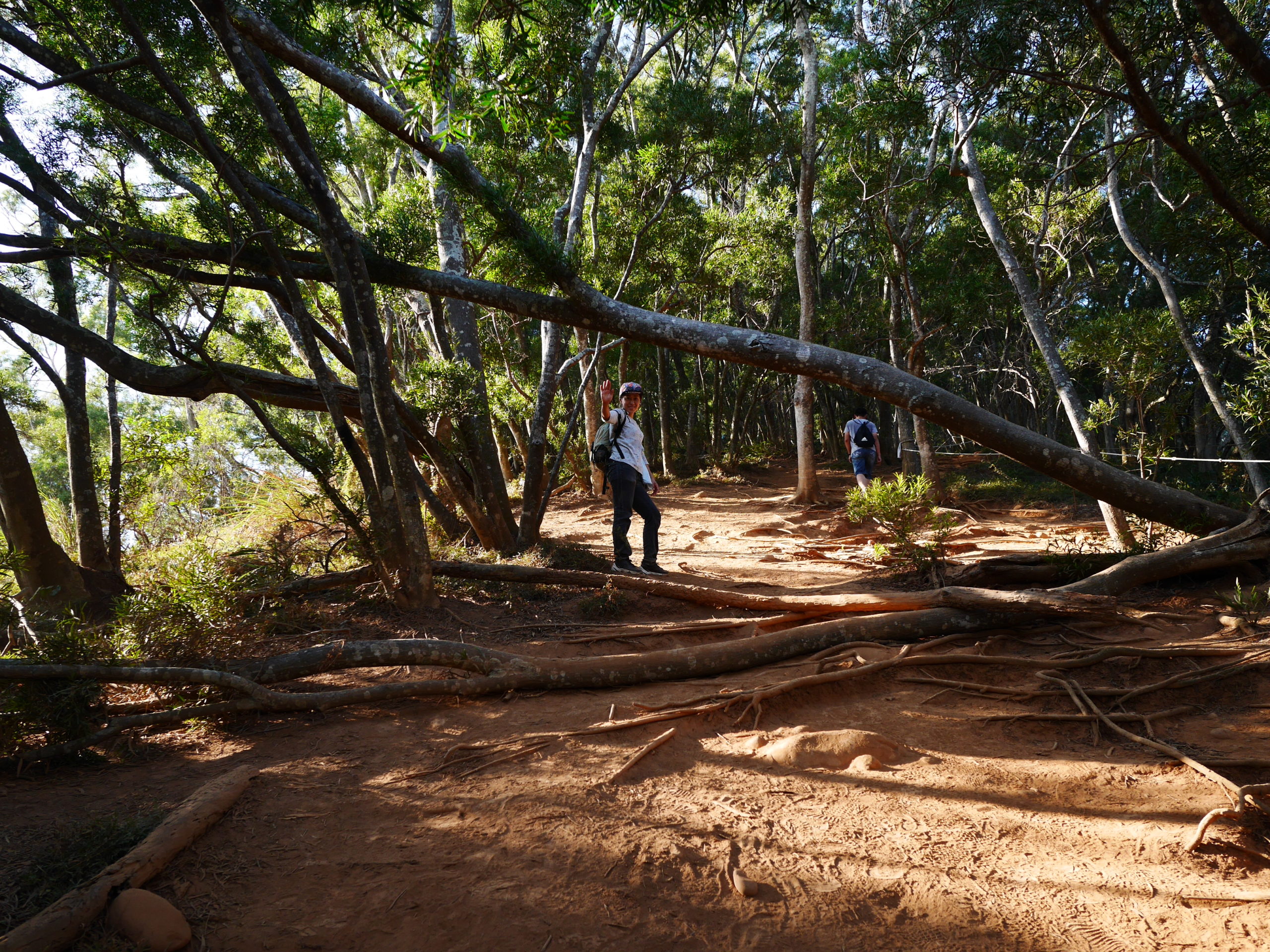
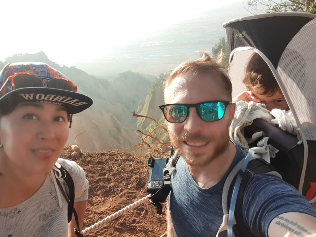
The whole family 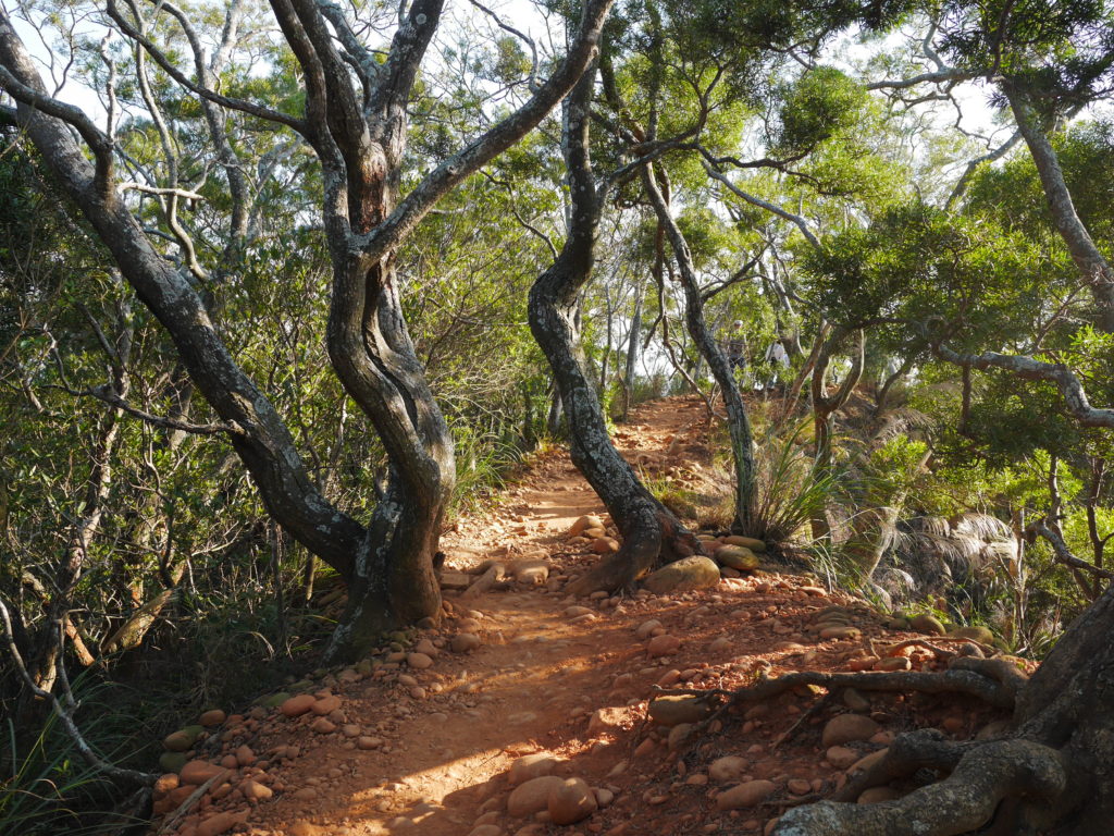
I love the way the trail passes between these trees 
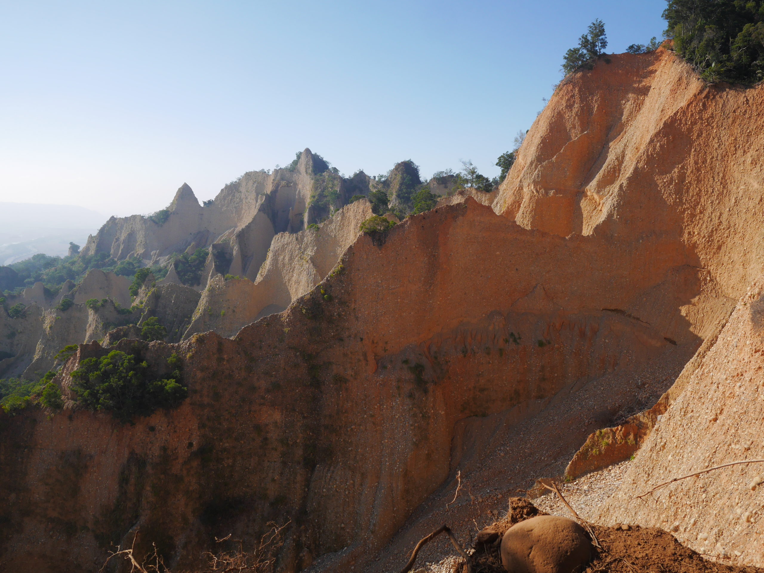
Flame cliffs 
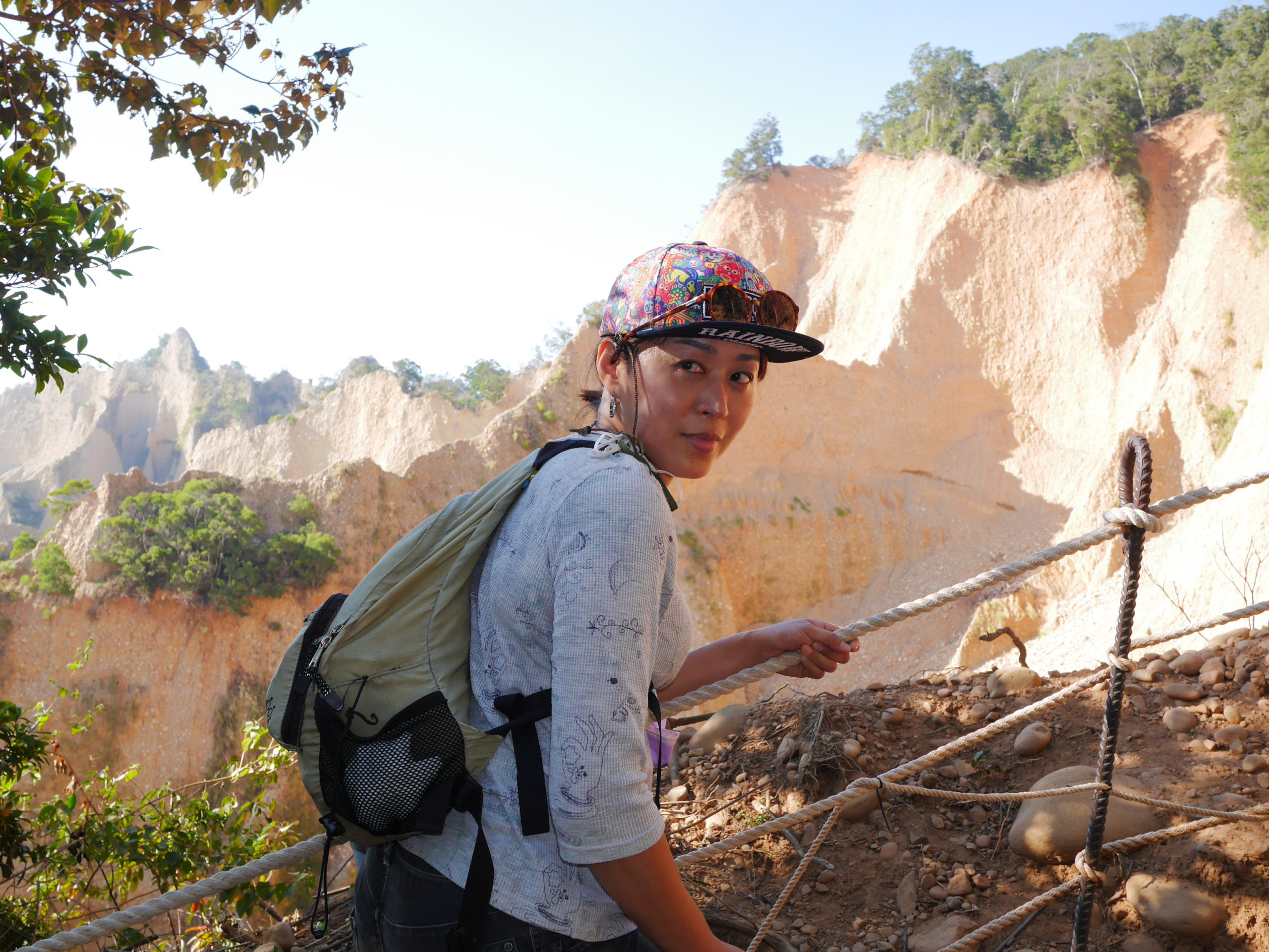
Yini in front of the flame cliffs


At roughly the two kilometer mark you reach the best point for viewing the “flames”. From there the trail goes up and down over several lower peaks before reaching a crossroads at which you can go directly through the jungle back down to the trail head or take a short detour up to the main peak. This part of the trail is less interesting than the first because the orange cliffs are all covered in vegetation and it looks more like any other mountain in Taiwan. My recommendation is, unless you absolutely must have the achievement of reaching the peak, spend some time taking in the view at the main view point, then turn around and go back down.
Cliff top selfie 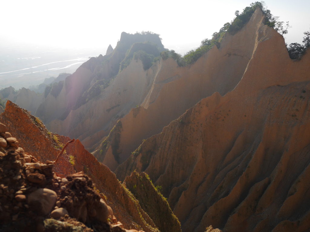
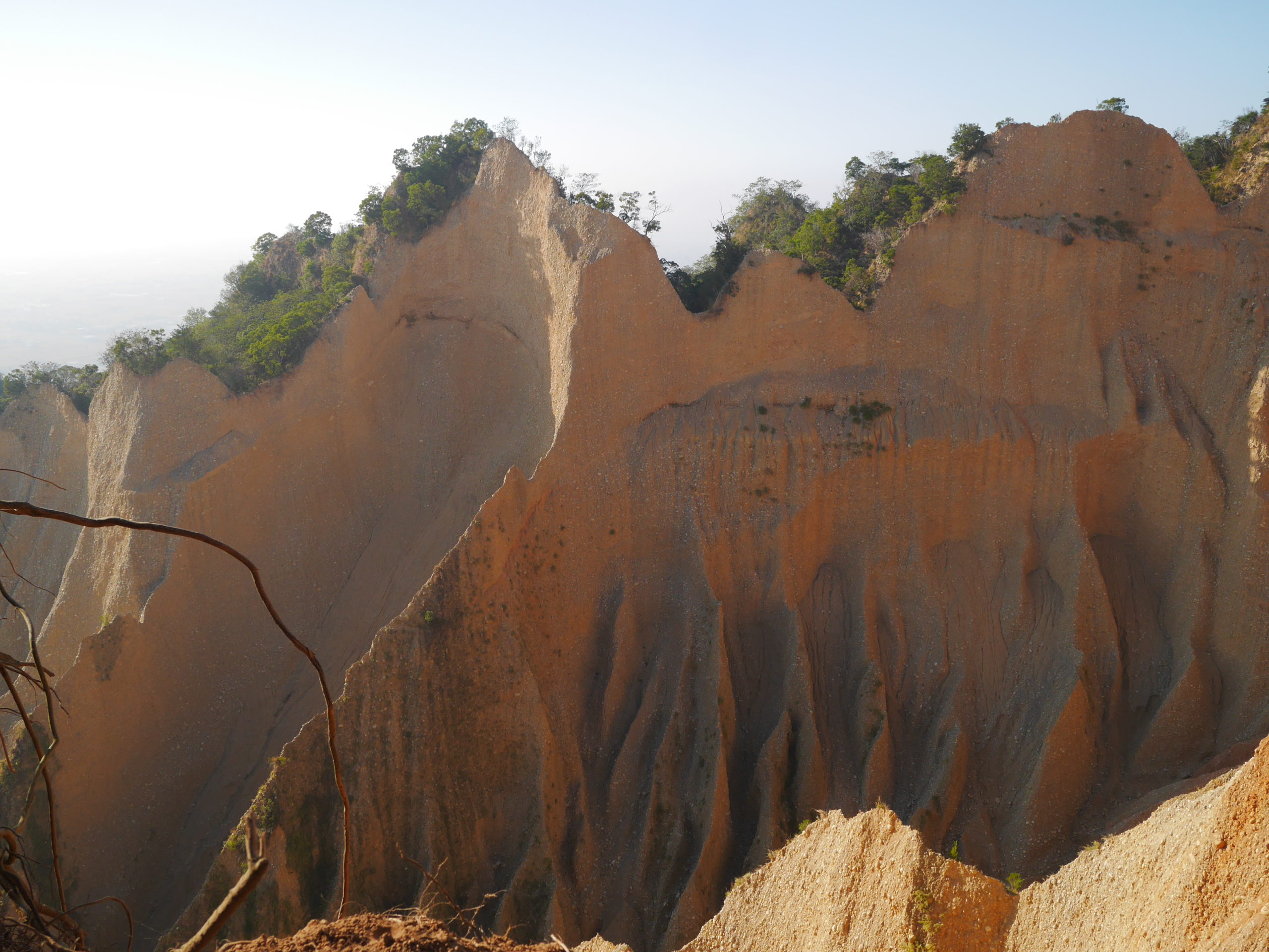
One last shot of the flame cliffs


The flame cliffs are beautiful and we enjoyed the hike as long as we could see them but as soon as they disappeared into the jungle behind us, it felt less interesting. We kept going anyway because I wanted to reach the peak but I have to admit it was a bit too long of a hike for us. I think it would have been more enjoyable to turn around at the main view point. Overall not a bad outing, but could have been better.
So what do I think about the information from The Map Room? The basic information is really good and there’s much more precise route data than Google maps can provide. There are also some good general hiking tips about shoes and clothes and such. However, I think The Cartographer really underestimates how strenuous this hike can be. It’s not so much the steepness of the trail, but rather the heat and exposure to the sun that gets you. There are two first aid stations with heart defibrillators placed by the trail side (they look new so I guess they weren’t there when he wrote his post) and they must have been installed there for a good reason. Like I said, I think any reasonably fit person can hike this trail, but it’s important to give yourself the time to take breaks along the way, and to drink enough water on hot and sunny days. The Cartographer also claims he did the entire thing in 2 hours and 20 minutes which I think is rather optimistic for people who aren’t as strong hikers as he is. All in all it took us around 3 hours and 45 minutes and I suspect families with small children would need around the same. For someone only bringing a small backpack, I think around 3 hours is realistic. I guess that the info on The Map Room gets a little bit skewed by the perspective of of the guy who runs it, who is an experienced hiker, and you need to keep that in mind. Other than that it’s a great place to find relevant info about hiking and other outdoor activities.
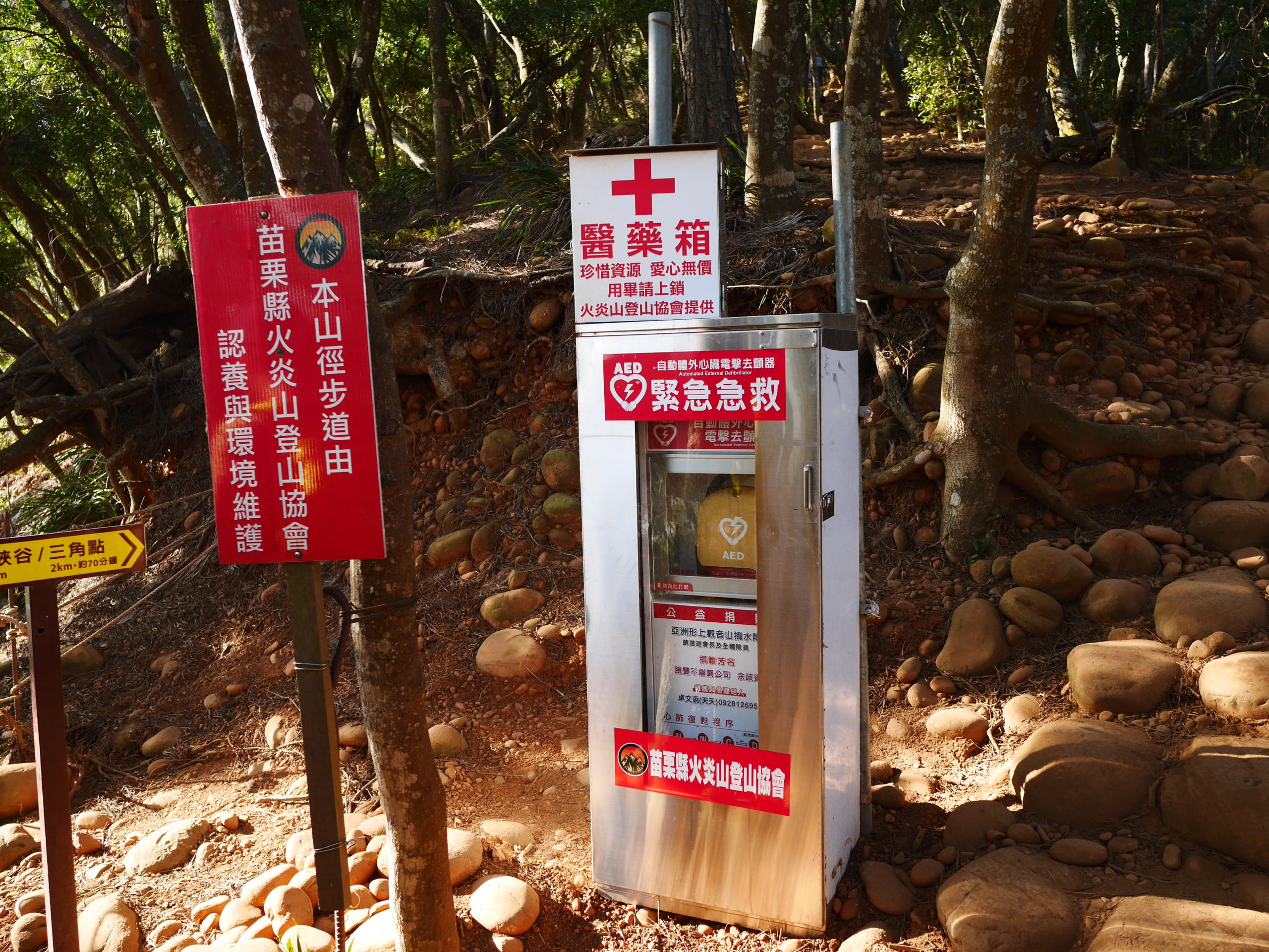
Defibrillator station 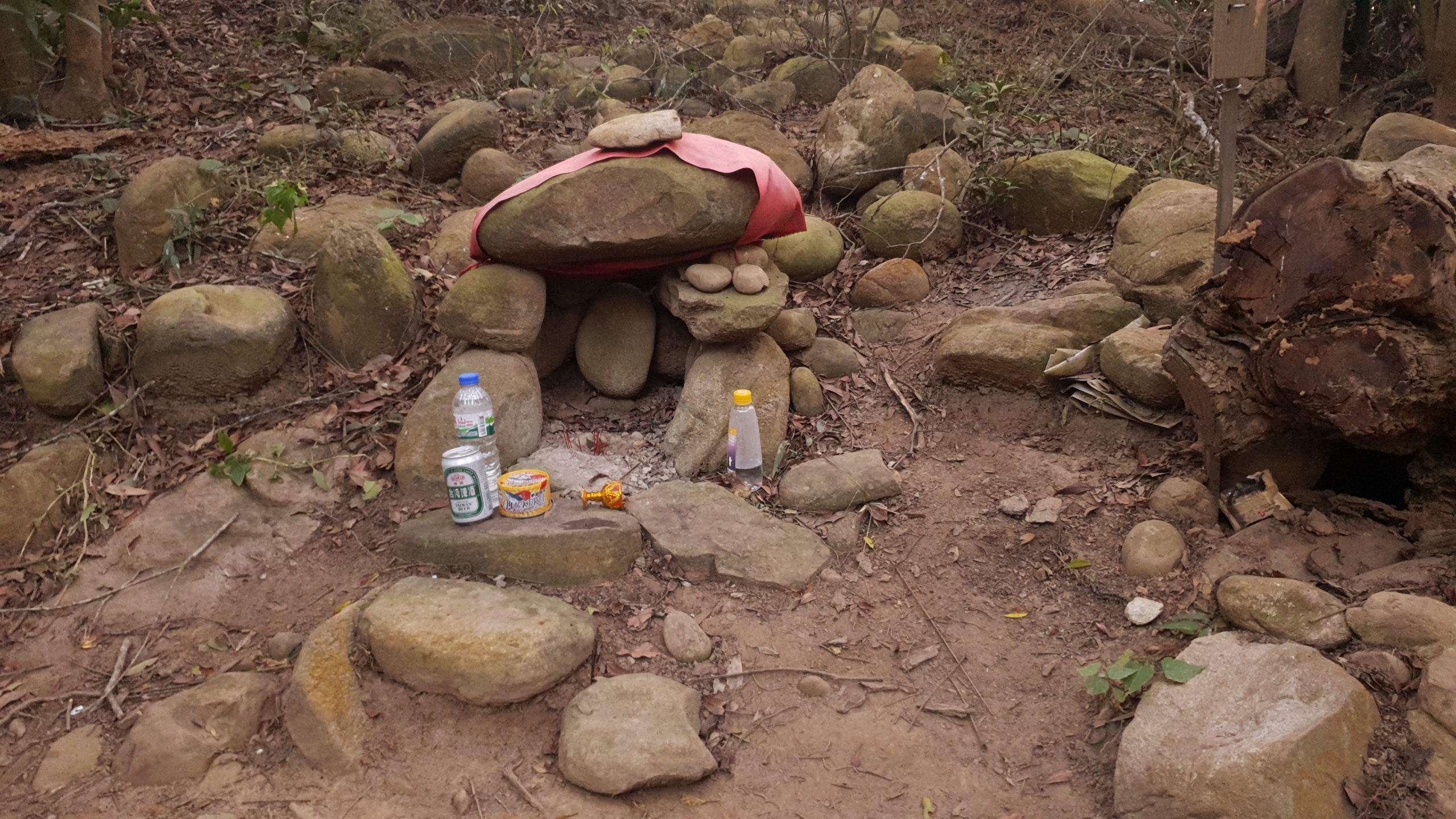
Tiny shrine near the end of the trail
November 26, 2021 at 09:45
Thanks Anders Twetman, you’ve written a good article here. New perspectives and information help us to keep things up-to-date over here, I will update the article with some information that you provided for people with toddlers. If you have more specific ideas about what to include in that kind of update I would welcome the input!
In the original Map Room article it’s noted in the important details section at the end: “Sun protection: Advisable. While there is plenty of shade along this hike, there are also many exposed areas.” It’s also noted that there are no water sources. If this is unclear, I would be very happy to update it with a clearer wording, suggestions are definitely welcome!
Your information about how long it took you is also useful. When I went, it was on a casual walk with my previous girlfriend and we stopped to take all kinds of pictures and make sure her Instagram photos were just right and had plenty of breaks, but we still only took that amount of time. I imagine it must be very different with a toddler on your back, so that input will be very helpful as an article update.
If you don’t mind, it would be great to link your article as further reading about Fire Mountain. I’d also welcome you to link mine if you like.
November 26, 2021 at 23:03
Copying my reply from facebook: I think an update with info for families with small kids can be useful. Except for some of the stuff I mentioned in my post, I don’t have much to add.
Regarding the part with the sun protection and lack of water sources: I don’t think the wording is unclear per se, but to me it indicates that you should put on sun screen and wear a hat. If i were you I’d add something about the risk for heat exhaustion / heat stroke.
I have no doubt you guys did it in that time. My point is that people shouldn’t read your blog and expect to do it that fast. maybe I wasn’t so clear about that.
I already have a link to your post in the first paragraph of mine. Feel free to add a link to my post when you make the update to yours.