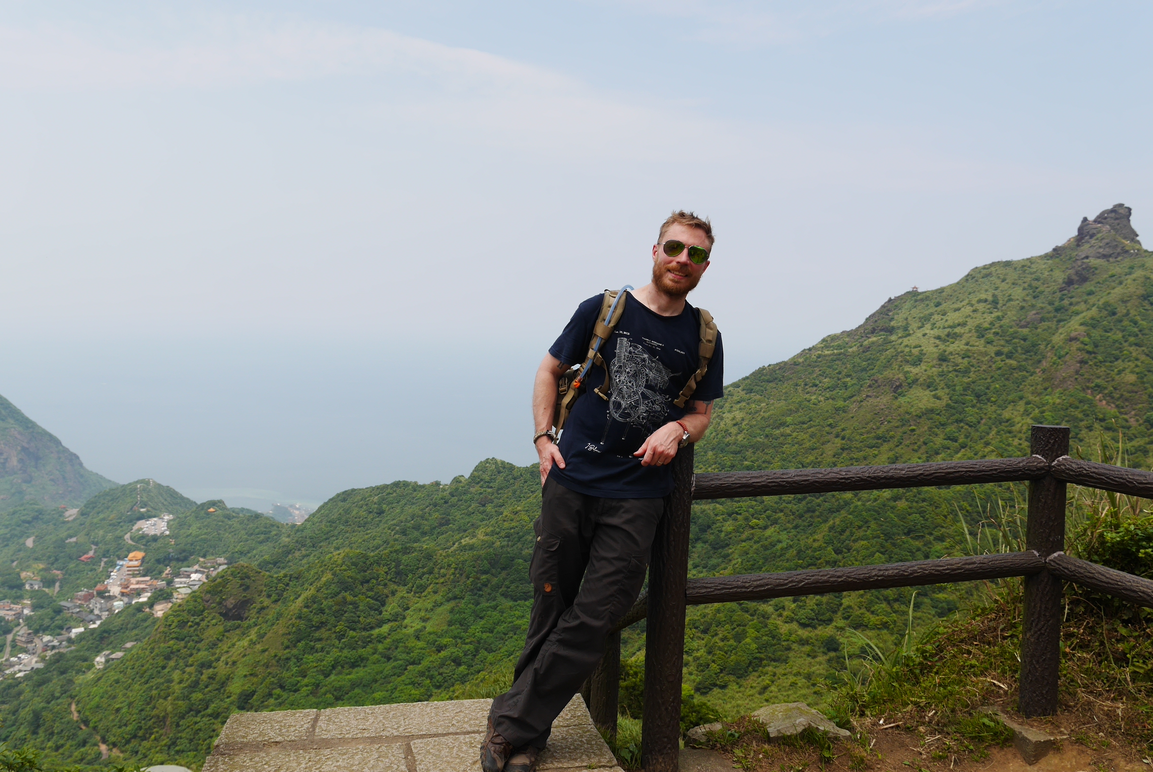
Last year I found out about an interesting hiking trail at Teapot Mountain (茶壺山) in north east Taiwan. I tried to do it back then but due to bad planning I had to turn around before I was able to finish the whole thing. Last weekend I decided to give it another try and this time I would plan it better. Teapot mountain is near Jiufen which is a nice place but it easily gets crowded in the weekends. In order not to spend too much time searching for a parking spot and then having to walk a long distance just to get to the start of the trail, I decided to take the motorbike so I could park as close as possible to the trail head. One major reason I didn’t finish the whole trail last time is that I arrived too late in the day, this time I rectified this by spending the night before in Taipei so I could arrive relatively early in the morning.
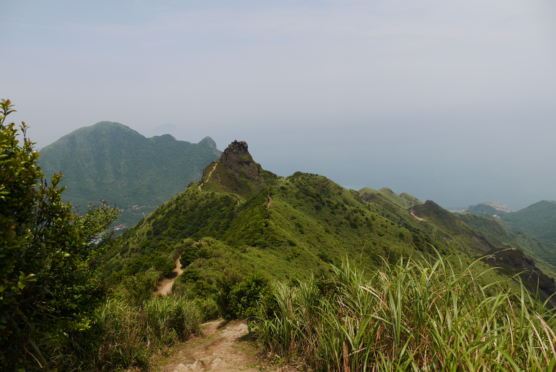
If you look at the map, it looks like the peak of Teapot Mountain is only a short distance from the road but trail actually continues from there another peak called Banpingshan (半平山) then goes around in a large circle, eventually coming back to the start point.
Map view of the trail
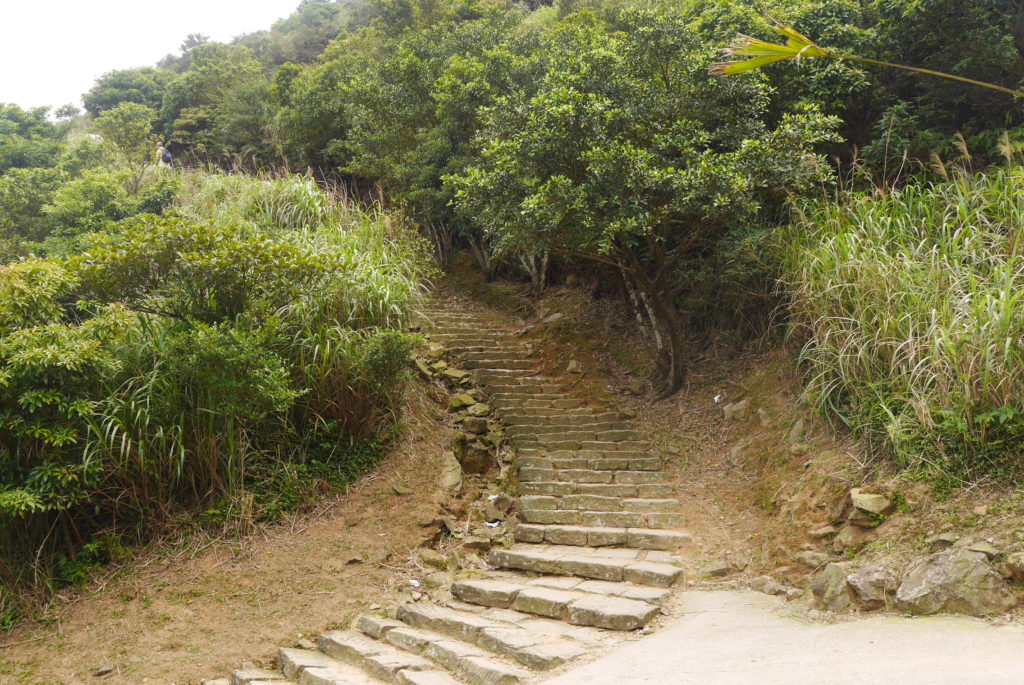
In my opinion the most convenient place to start is the New Taipei City Government Gold Museum (黃金博物館) not far from Jiufen Old Street. As far as I know you don’t need to pay the entrance fee since you’re just passing through the museum grounds. Go all the way through the museum until you find the old train tracks on the back side, then cross the little bridge over the river. Here you come to a fork in the road where you have two choices: to the left you have a longer but less steep walk along a normal road, to the right you have a set of stairs that require some effort but save you some time. I prefer the stairs to cut down on time walking normal roads but you can take the long way if you want to save your energy.
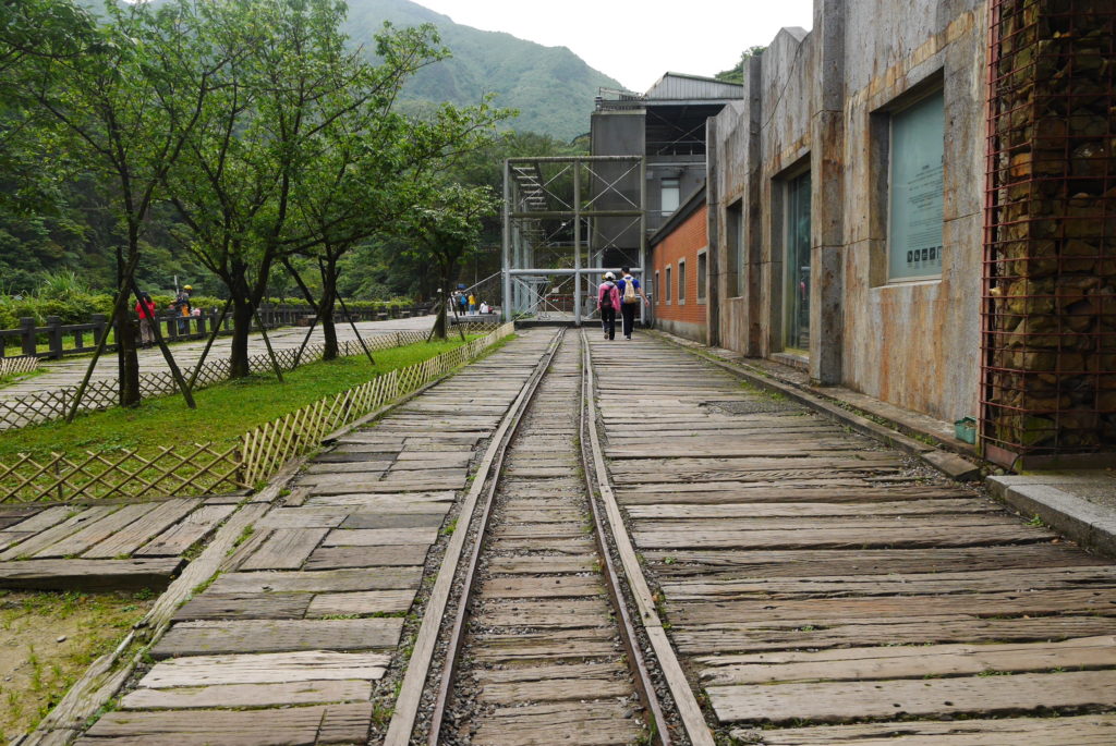
The old tracks at the back of the museum 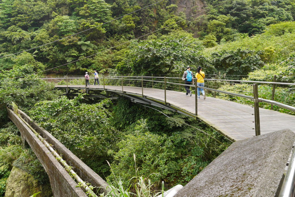
The bridge over the river 
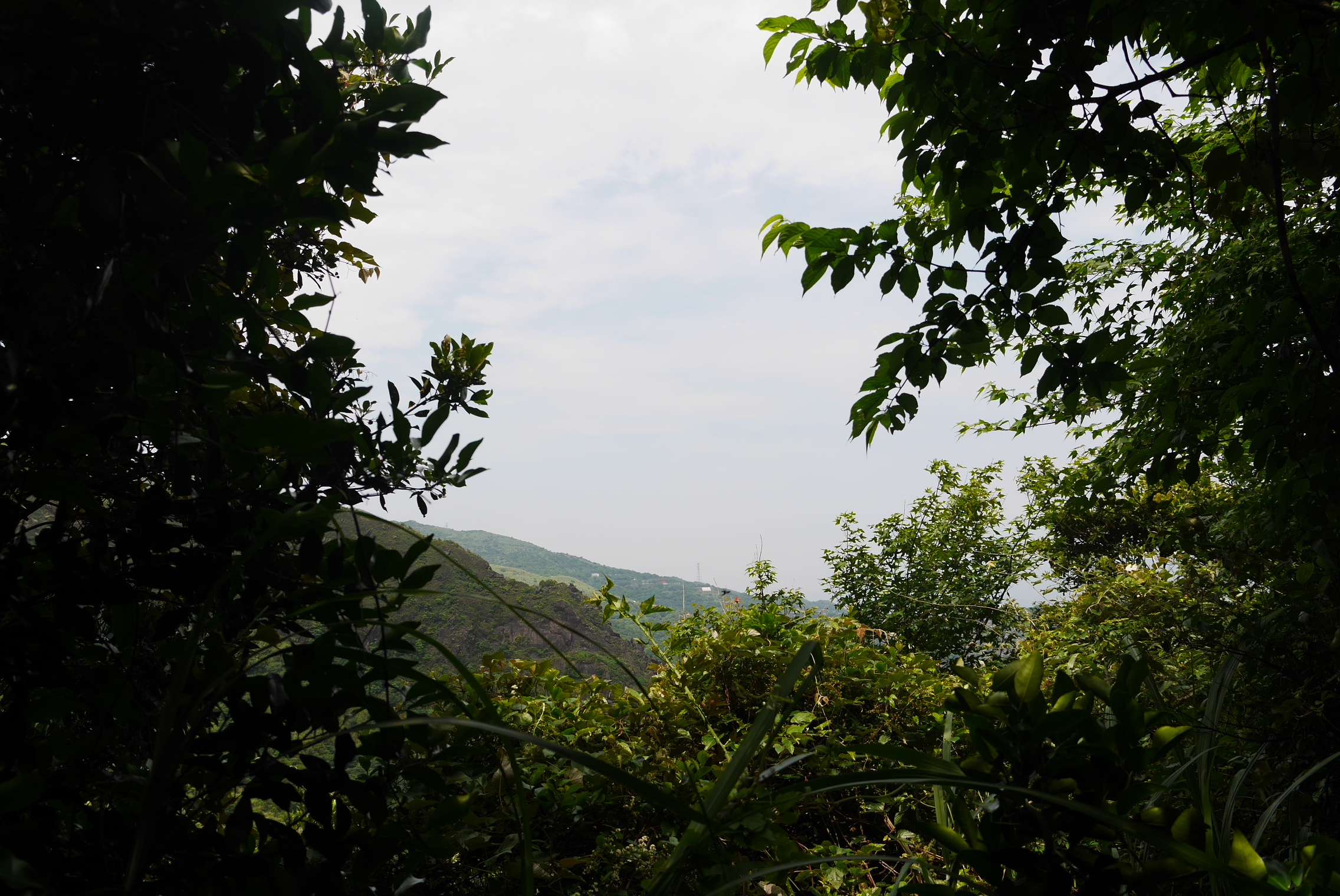
Getting a peek of the view halfway up the stairs
The two trails merge again after a little while and you have to walk a short distance along the normal road before you reach the start of the actual trail. Soon after entering the real trail there’s another fork, take the one to the right to get to the top of Teapot Mountain, I’m not sure where the left fork leads.
The start of the actual trail 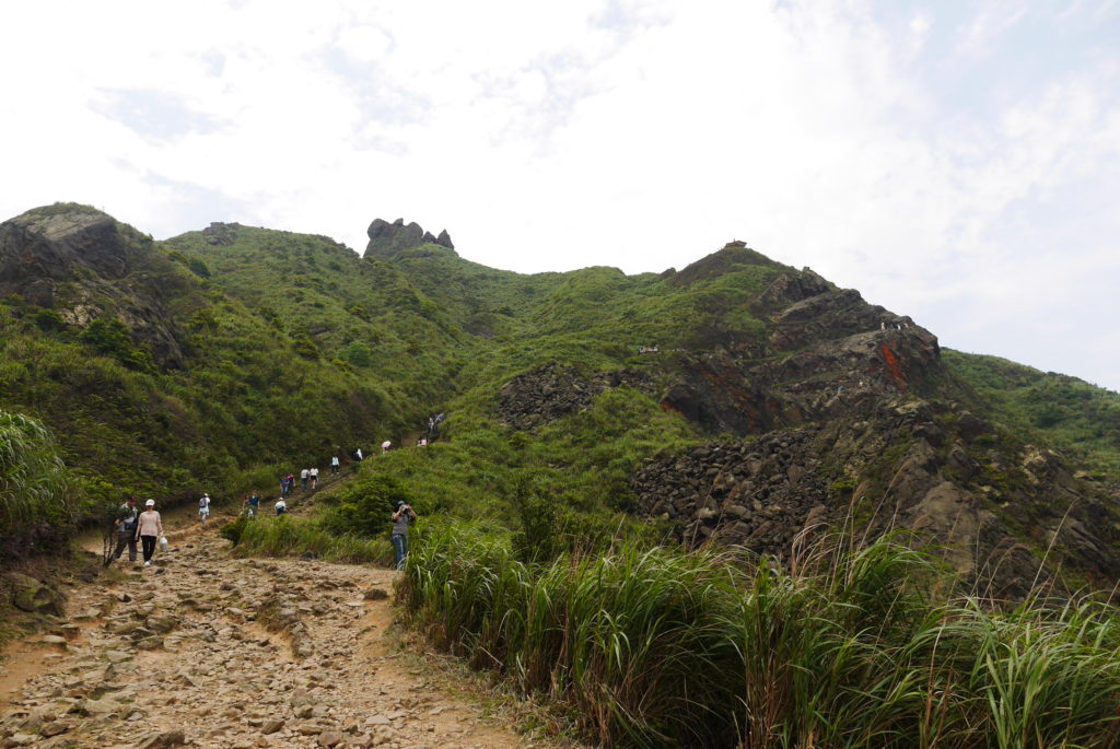
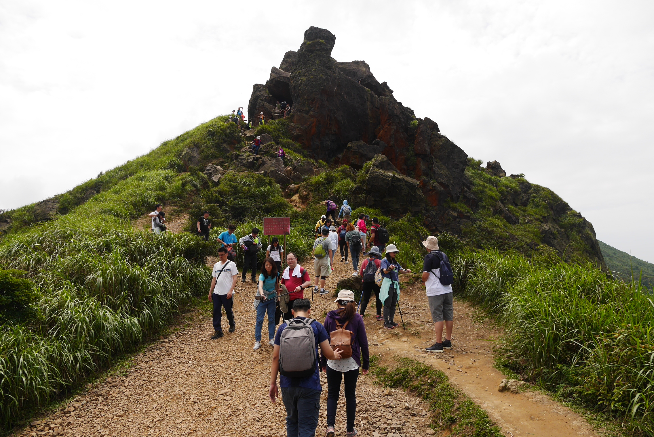
Starting to climb, the goal up ahead

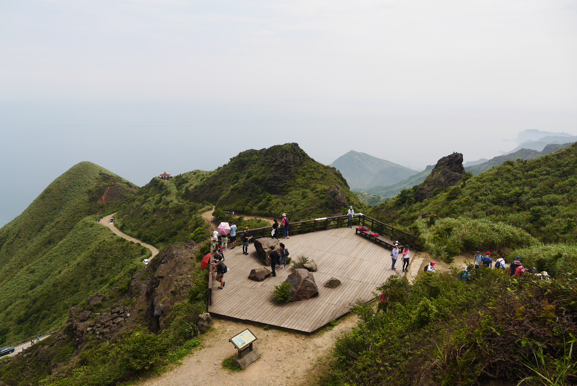
About half way up to the top there’s a viewing platform where many people like to stop to rest and take selfies. Up at the peak plateau there’s also a pavilion where you can get some shade if there aren’t too many people. After resting a bit here it’s time for the push up to the actual peak.
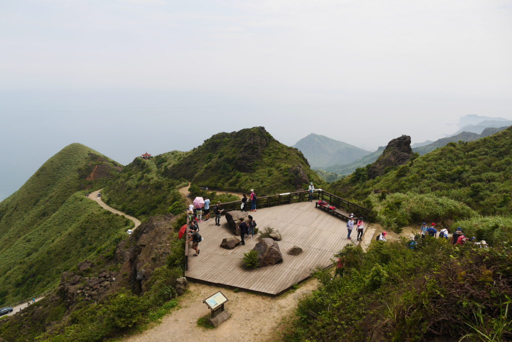
The viewing platform, great place for some Instagram photos 
The peak trail, despite arriving early there was a fair crowd here 
The view from the peak down towards the pavilion
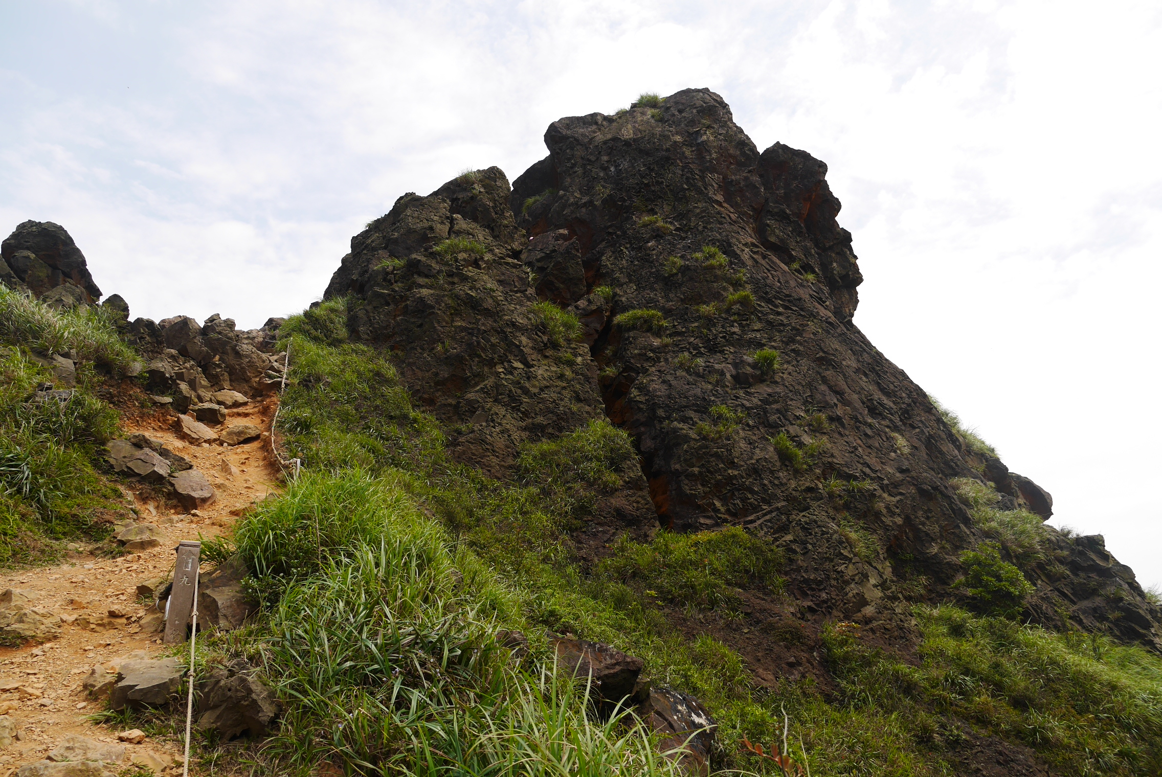
The peak of Teapot Mountain is one of the most interesting parts of the trail.There is a big boulder up there nestled between some cliffs forming a small cave. There are two ways through this cave, the most obvious one goes upwards to a small ledge where you get a great view of the landscape but you get stuck in a dead end and have to turn around. If you want to continue the trail you should instead go downwards through the cave and come up on the other side of that ledge where you can get back down to the path.
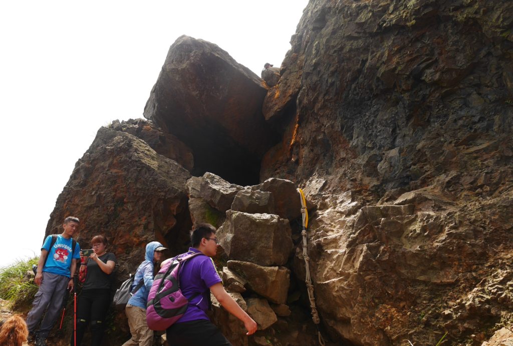
The cave entrance 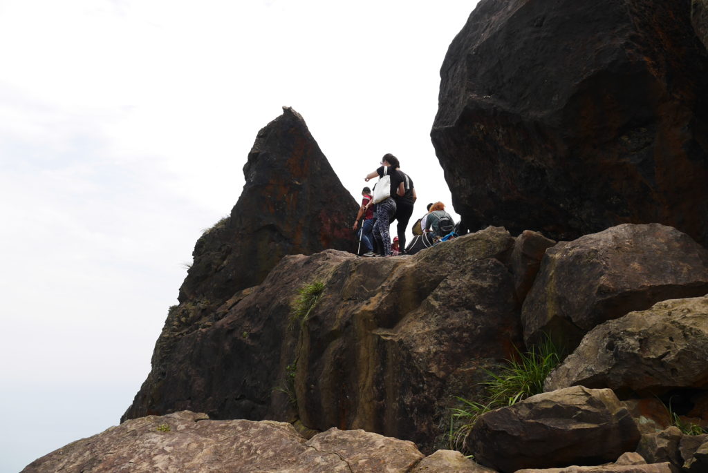
The summit from the other side 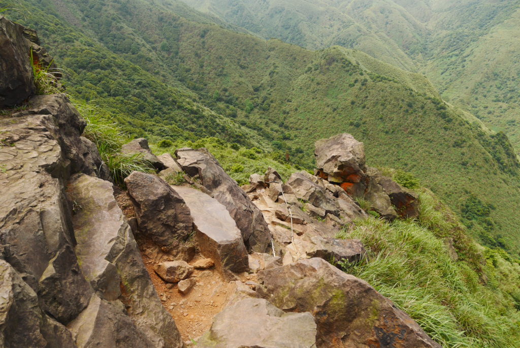
The way back down to the trail 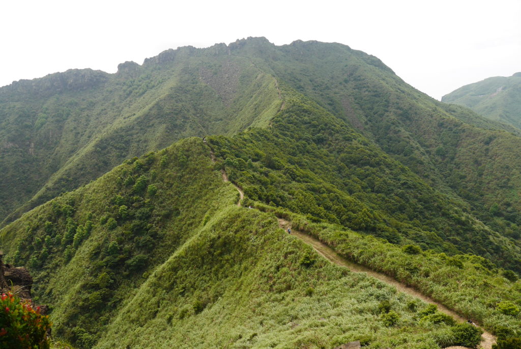
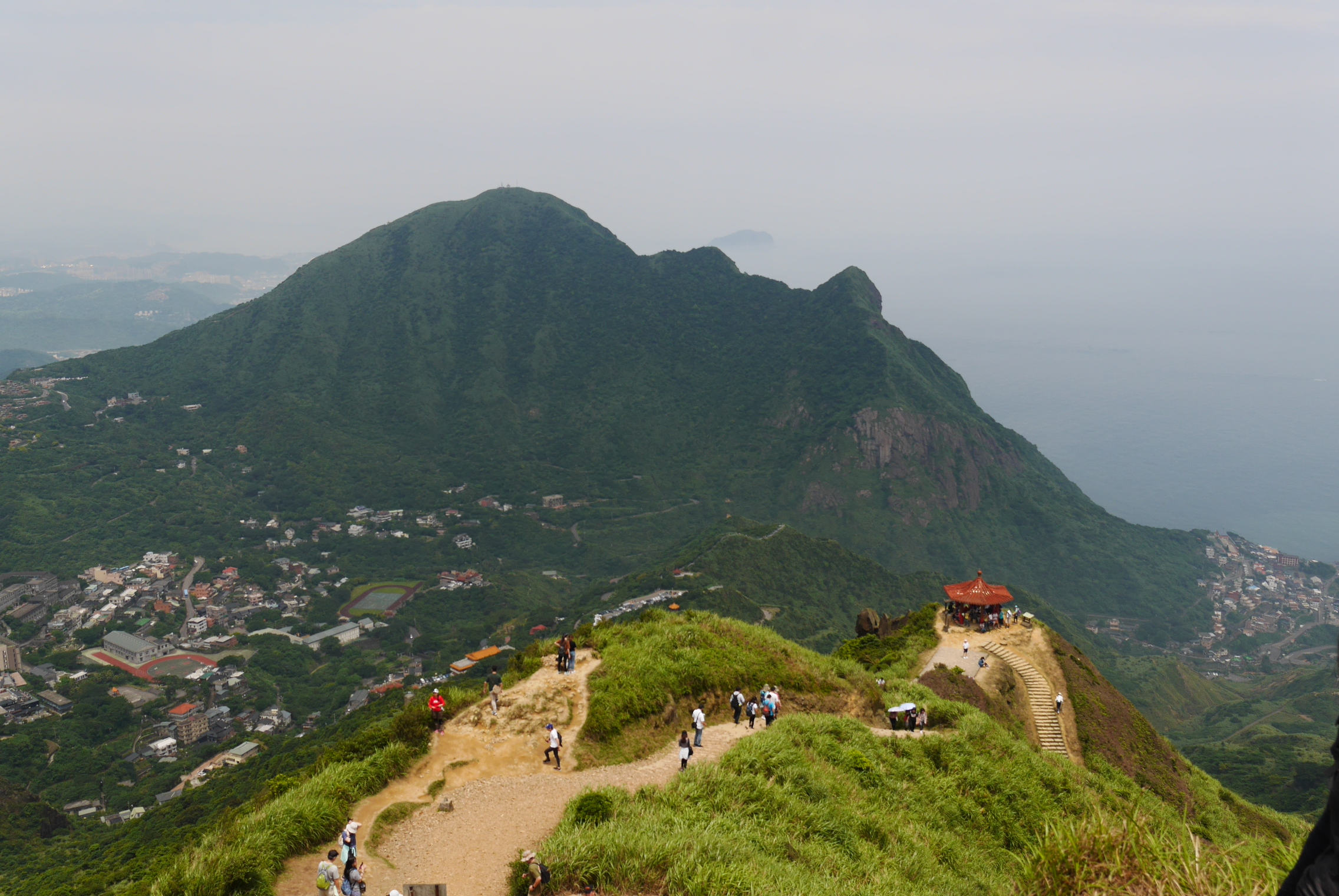
The trail towards the next goal, Banpingshan 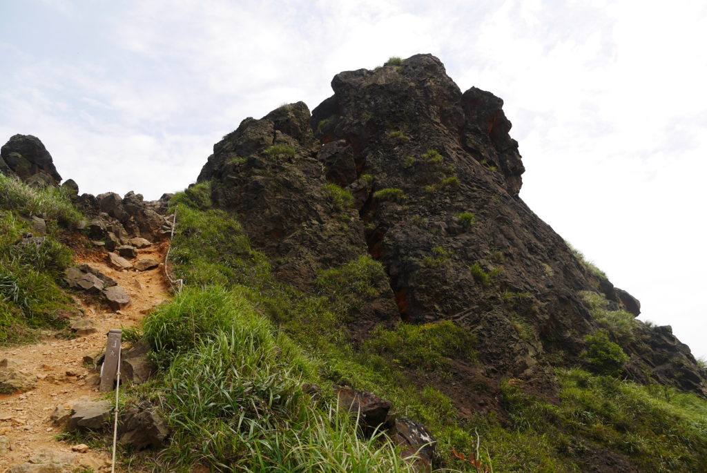
The peak from the other side and the last bit of the path up to it 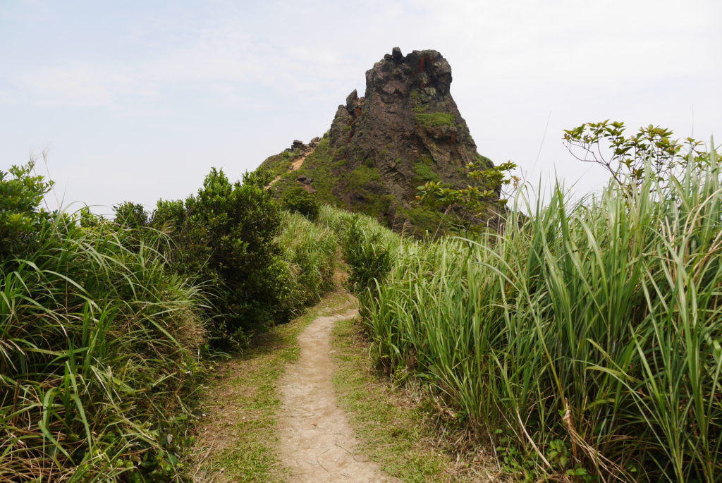
Looking back 
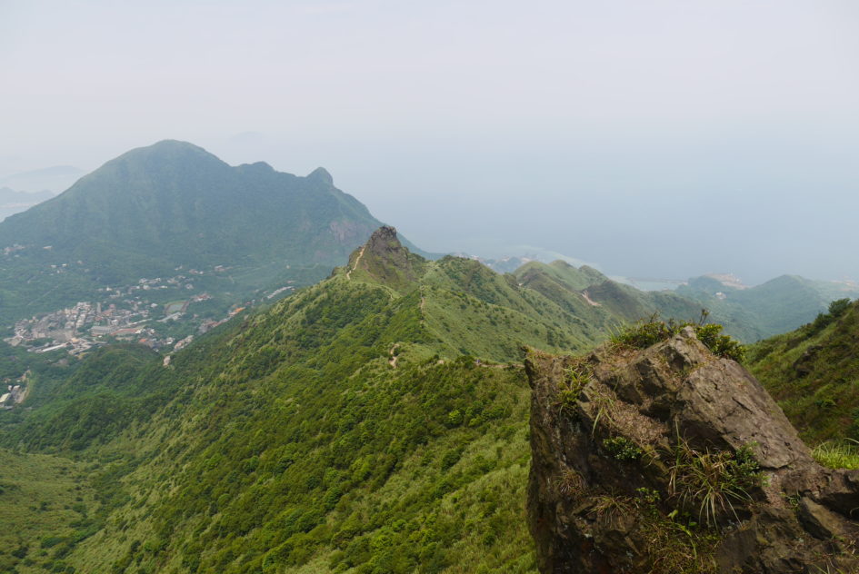
Teapot Mountain from about halfway up to the next peak

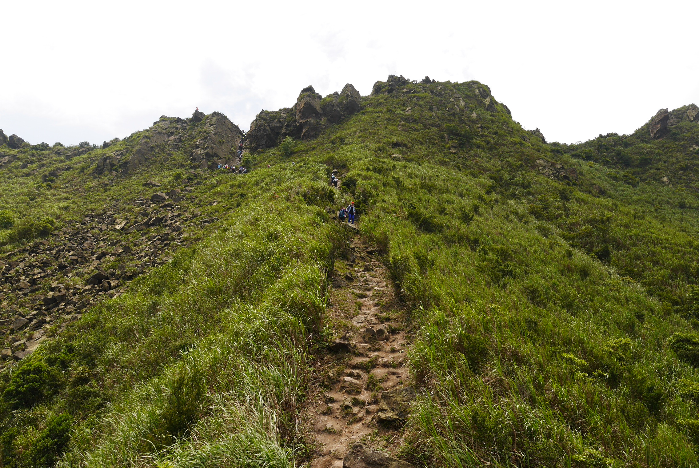
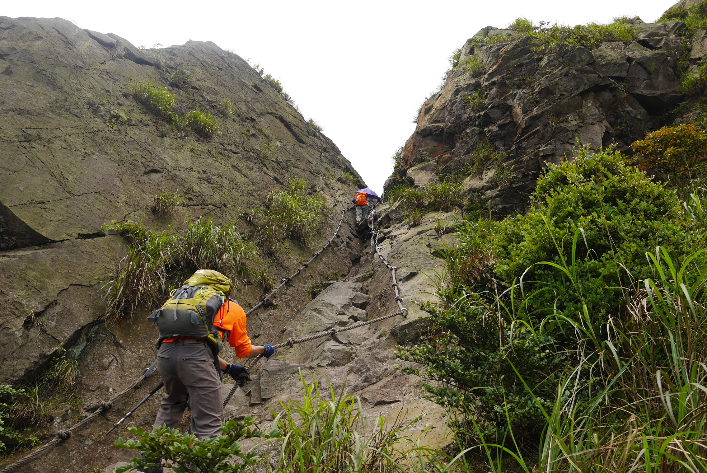
After a bit of fairly normal hiking you reach the next peak, Banpingshan. Here is another really fun bit of the hike: the trail is blocked by a near vertical cliff, probably five to ten meters high, and you have to climb it to continue. There are some good footholds and a couple of thick, knotted ropes for your hands so it’s easy to climb and relatively safe but pretty thrilling none the less.
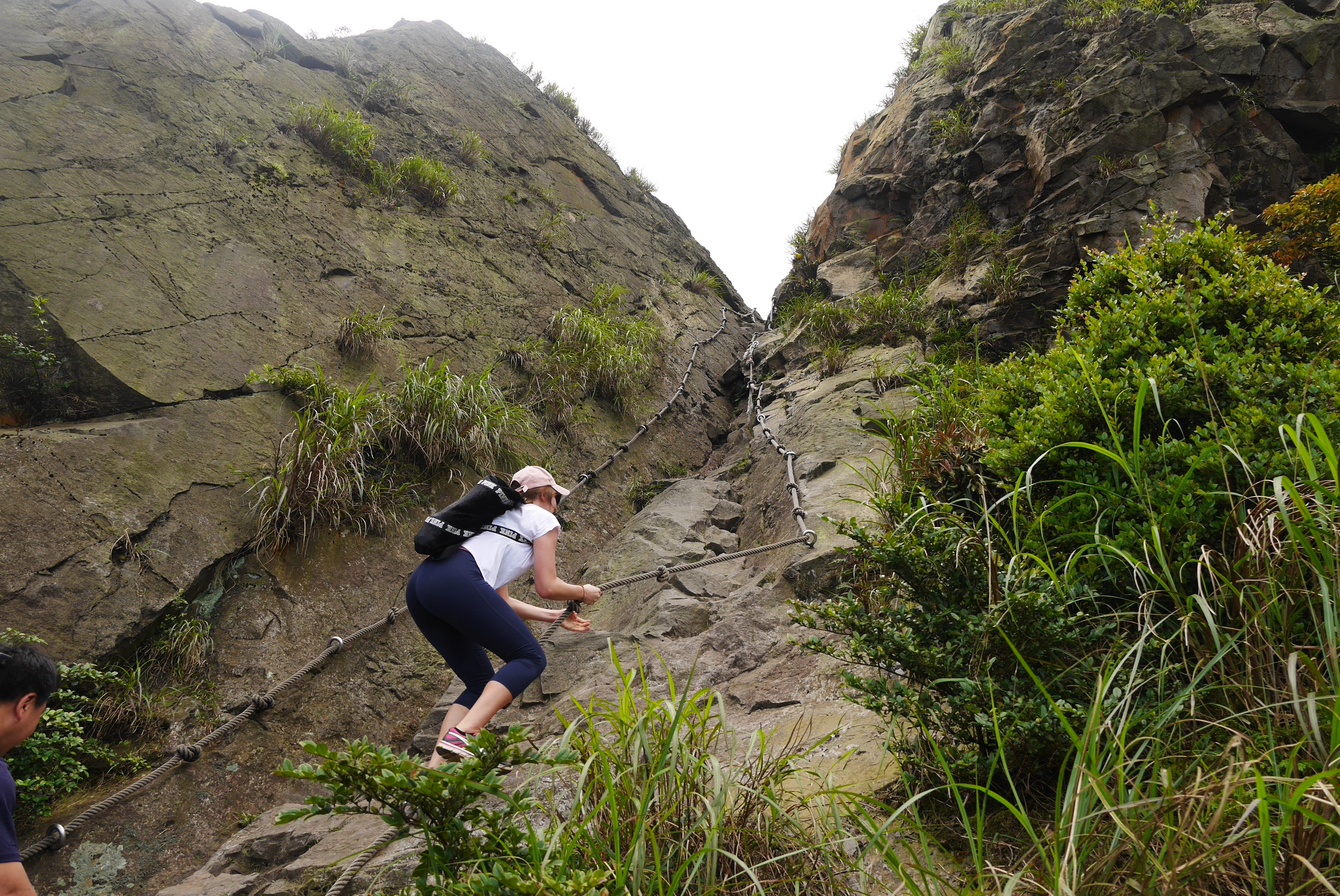
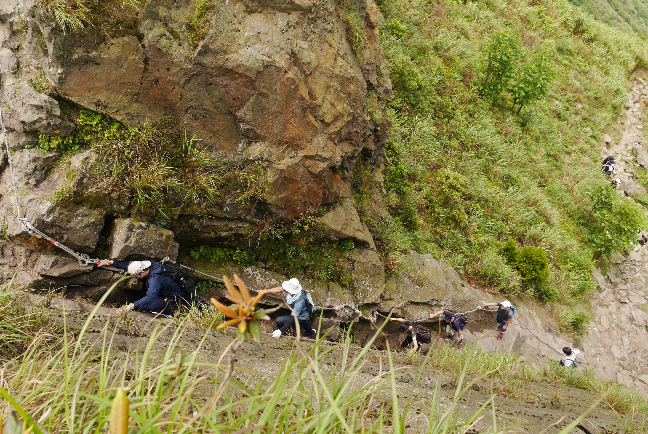
Once you’re up you have to walk along the peak ridge for a few hundred meters. It’s pretty narrow and slopes off to one side but there are ropes to hold on to so don’t worry. The view from up there is really fantastic with lush green mountains all around and the oean in the distance.
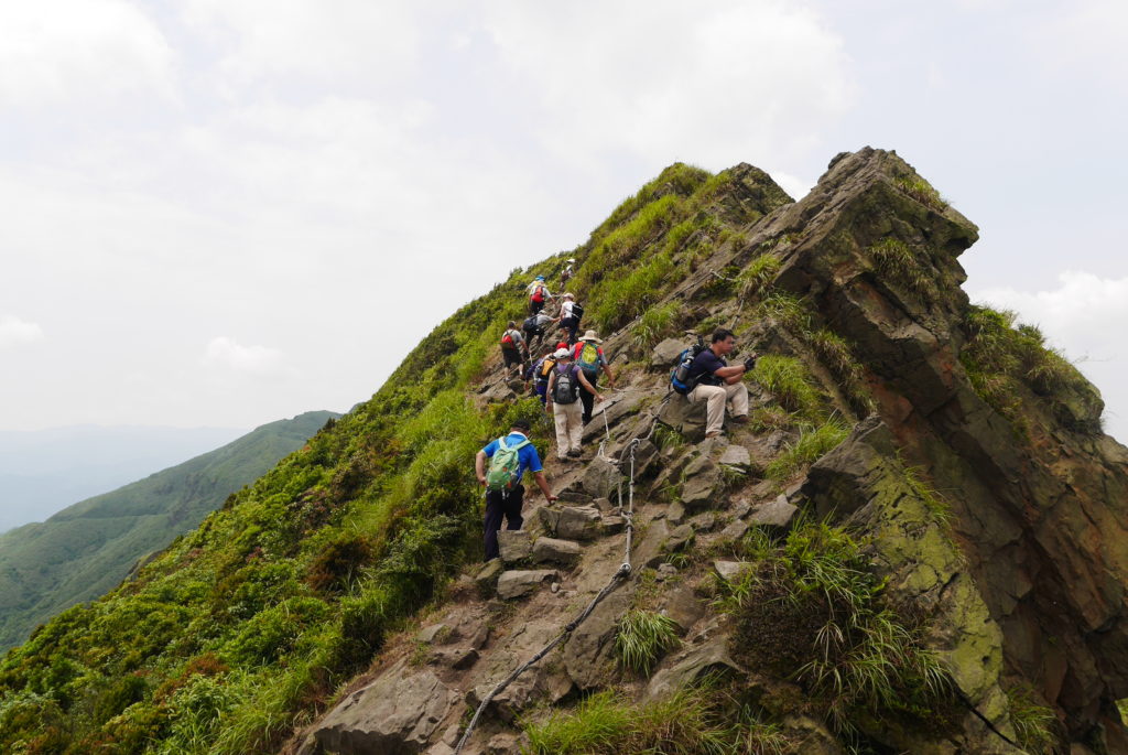
Starting the peak ridge climb 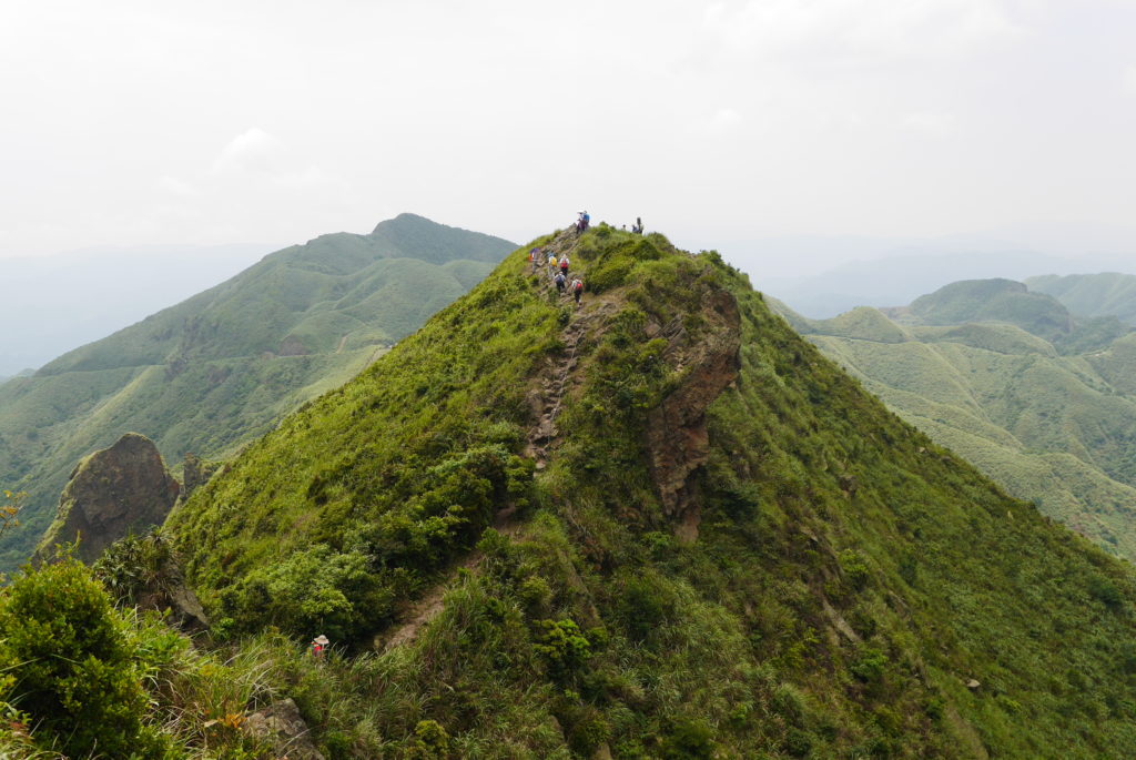
Further along the peak ridge 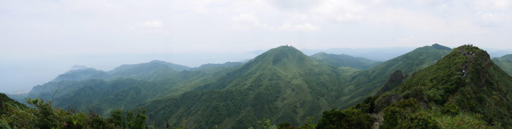
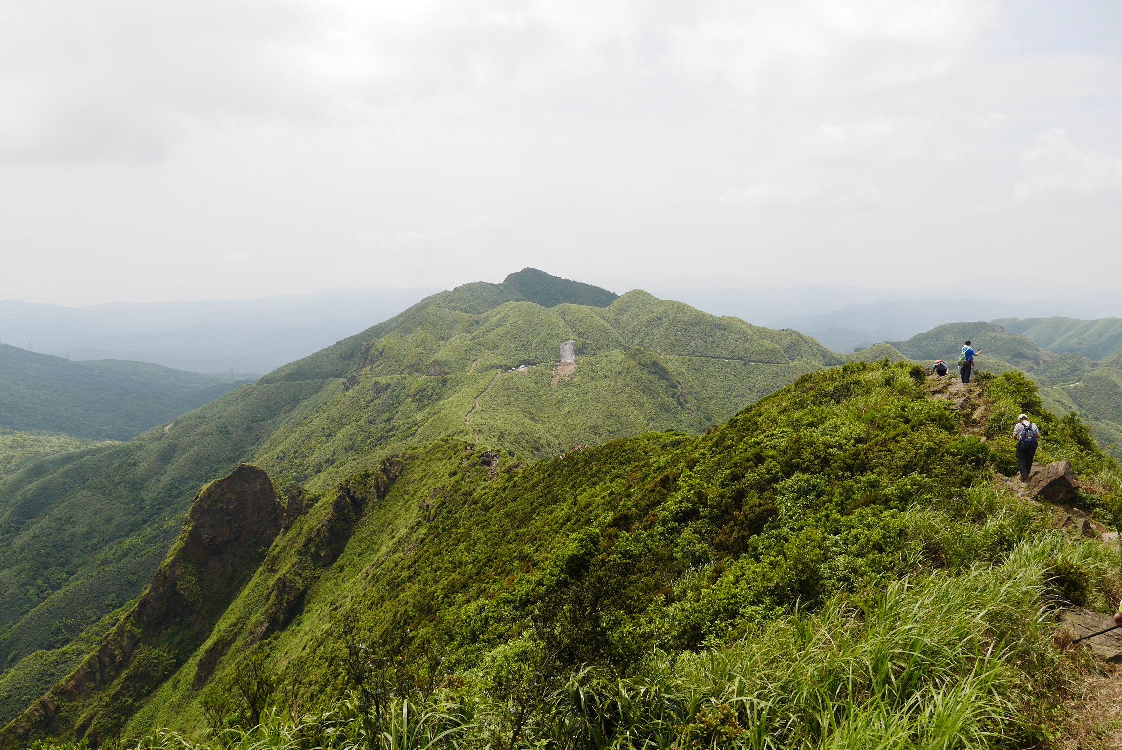
Landscape view 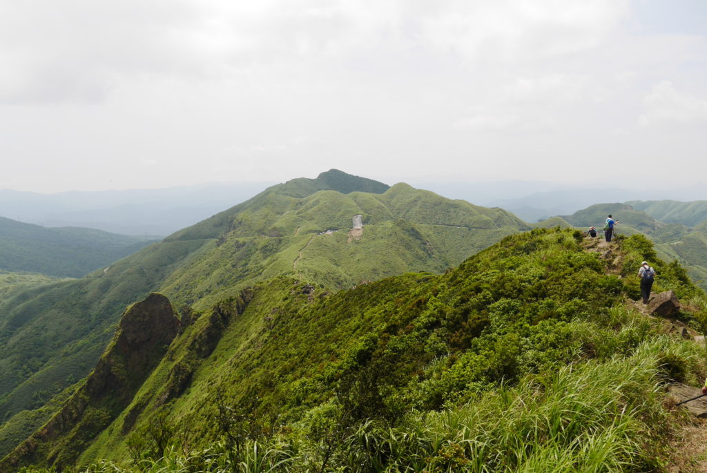
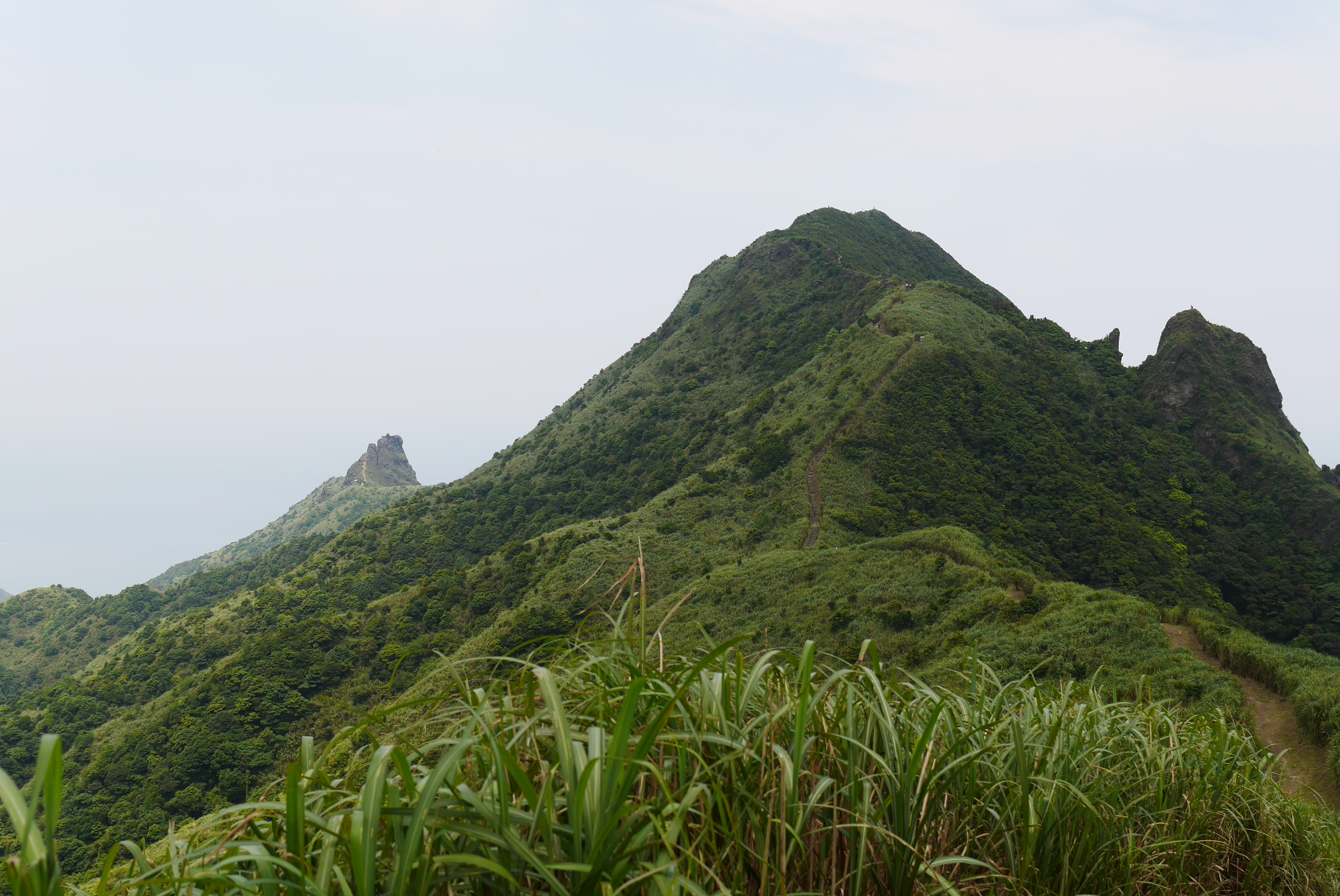
The end of the peak ridge and the road in the distance
When the peak ridge ends you have some pretty normal hiking down to the nearest road. You walk along the road for a little while then join another trail that takes you back down to the Gold Museum. There are a couple of forks in the road and to get back to the Gold Museum you should follow the signs pointing towards Jinguashi Geopark (金瓜石地質公園) and Jinguashi(金瓜石神社遺址) Shrine, which basically means taking the right fork every time.
I have to say it was a really nice little hike, I especially liked going through the cave at the peak of Teapot Mountain and climbing the large cliff at Banpingshan. The only downside is that it’s in a popular area so there are some crowds sometimes but you can avoid a lot of that if you just plan well and start early.
Leave a Reply